|
Home
Free Maps
Store
ORV Trail Maps
Snowmobile Trail Maps
Outdoor Recreation Maps
Service/Support
Contact
Privacy Policy
About Us
Mailing List
|
| Information on Michigan Cross Country Cycle Trail (MCCCT)
Back to Main Trail Info Page 
Michigan Cross Country Cycle Trail (MCCCT)
Pg# 95-112 (PDF
95, PDF
96, PDF
97, PDF
98, PDF
99, PDF
100, PDF
101, PDF
102, PDF
103, PDF
104, PDF
105, PDF
106, PDF
107, PDF
108, PDF
109, PDF
110, PDF
111, PDF
112)
Width: 40”
Length: 689
Traffic: Some
County Rds Open to ORVs: Some
Forest Rds Open to ORVs: No
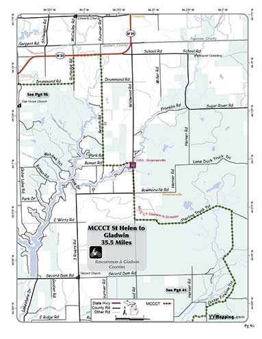
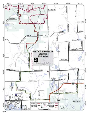
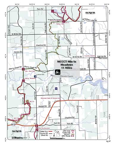
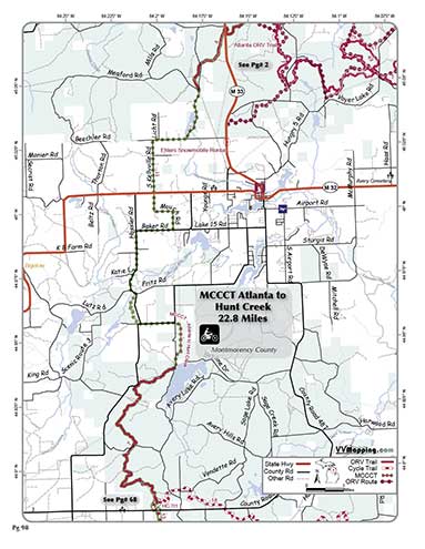
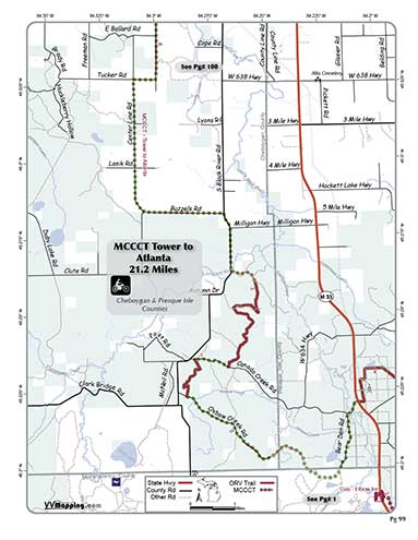
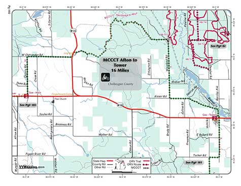
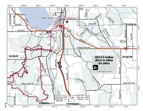
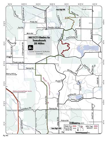
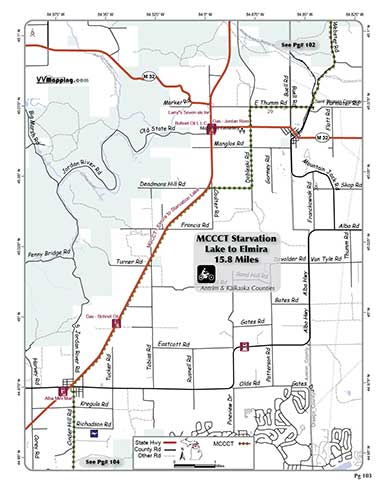
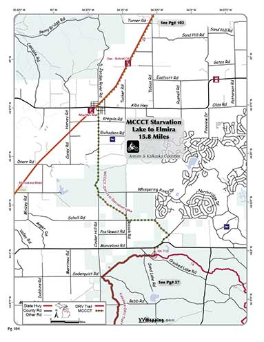
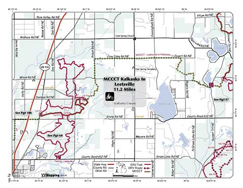
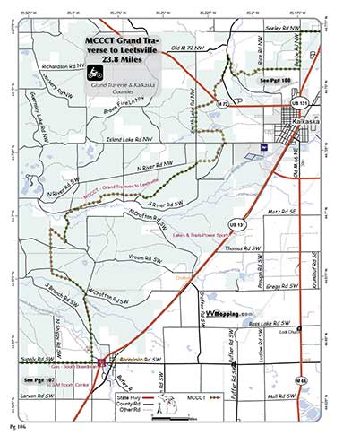
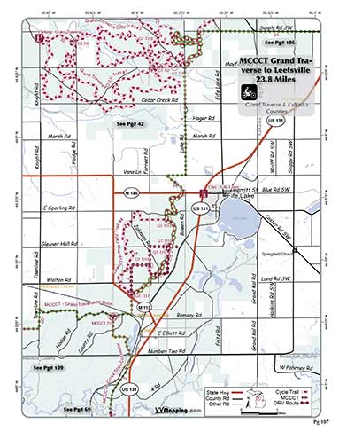
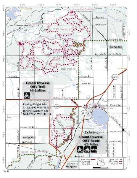
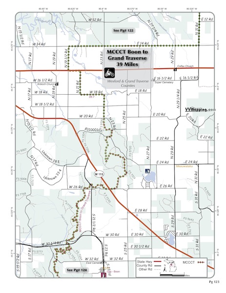
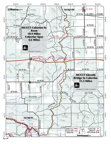
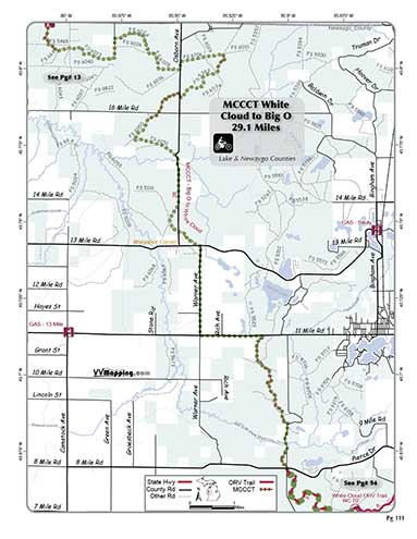
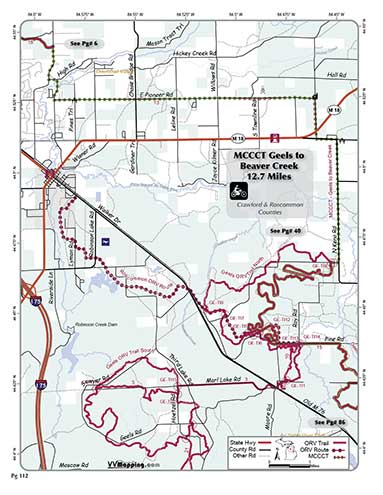
ORV Trail, Route, Roads and Highways. Forms a rough letter “A” in
the lower peninsula and connects many trail systems via trail and
road segments. County and State Road segments require Secretary
of State license. Forest roads, trails and other ORV Trail segments
require DNR license. Varies from unused, near “virgin” single
track, to paved State Highways. Provides a marked path for street
licensed motorcycles to connect various trails in the lower peninsula,
or a multi-day ride using just MCCCT. Terminates at M-20 on the
White Cloud system, connects northernly to Indian River; terminates
at M-61 on the Gladwin system. Cross State Connector terminates
in St Helen system and just south of the Grand Traverse System. See
Also the MCCCT main and additional
photos.
|
|
Back to MCCT Main
Information about this page Information regarding ORV use in Michigan
Trail Guide at a glance
Big Picture of trail locations
Map Book Information
GPS Map Information 
This work is licensed under a Creative Commons Attribution-Noncommercial-No Derivative Works 3.0 License
|
