VVMapping.com - providing high quality mapping products for outdoor recreation & Beyond
|
|
Information on Mi-TRALE Trail System
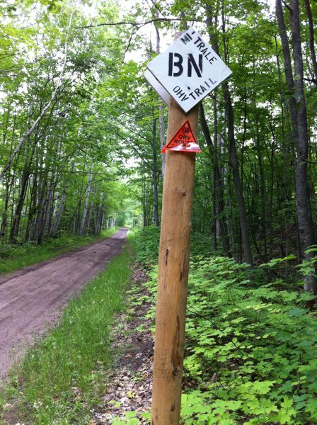
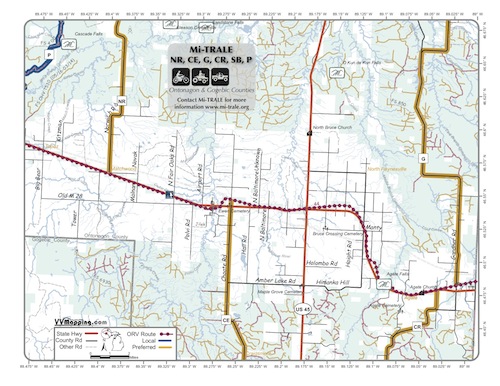
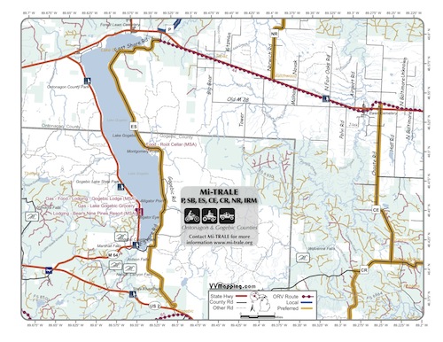
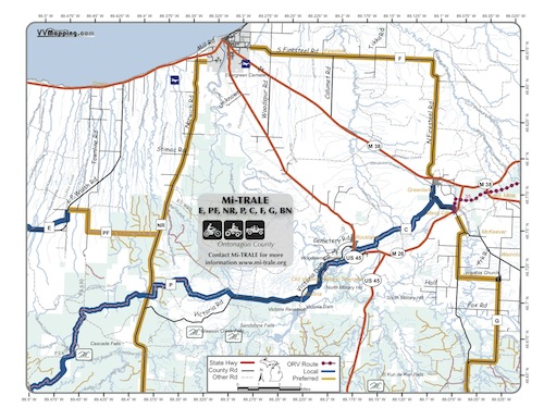
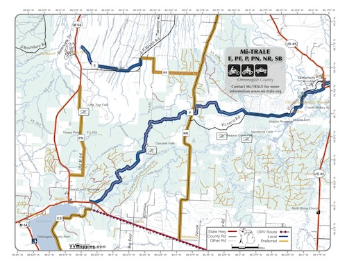
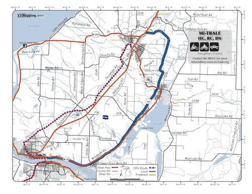
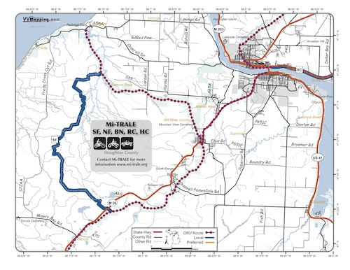
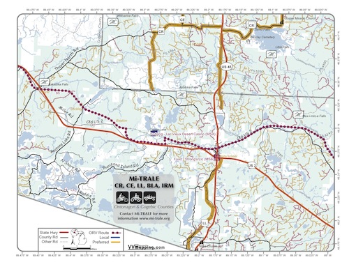
Mi-TRALE Updated 2/1/12 Note ground conditions and local club agreements have changed since publication in 2010, resulting in some of this information being out of date. Please pay special attention to the notes included with each segment for anything that is not part of the State's Designated System. Michigan Trails and Recreation Alliance of the Land and Environment, Mi-TRALE, is a Club in the western UP of Michigan. They have designated several preferred routes and trails with their own naming convention. This naming convention consists of 1 to 3 letters, usually an abbreviation of the road or trail. The Bill Nichols ORV Route, for example, is named "BN" in Mi-TRALE's system. The Club offers a map locally that covers their entire system. There are a bit over 200 miles of Preferred Routes and Local Trails and another 250 miles of State Designated ORV System. These routes and trails are marked with black letters on white backgrounds (note our experience has found the markings to be inconsistent). Example sign below. About half of their system is comprised of alternate names for existing ORV Routes or ORV Trails that are part of Michigan's Designated ORV System. The remainder are a combination of forest and county roads, including use of private property in some areas. Some trails are designated as "preferred routes" meaning these are the suggested way Mi-TRALE recommends you travel between locations; others are "local trails" indicating suggested travel ways that generally use existing (marked) snowmobile trail. Please note that several of the preferred routes terminate at a State or Federal Highway and ORV travel on these highways is illegal. For example the "PN" preferred route starts and ends at US-46; "C" stops at US-45 near Paulding, continuing on either side, but separated by 1/3 of a mile of this Federal Highway that is not open to ORVs. Additionally some of these local trails or preferred routes may be CLOSED or otherwise not open to public ORV Travel. Contact Mi-TRALE for current conditions. A GPX file is available for download, providing approximate track logs for the preferred routes and local trails. It can be used in your GPS if it supports track logs or viewed on your computer in various programs, such as Google Earth or Garmin's MapSource. This information is based off of an Mi-TRALE published map and no accuracy or representation of legal travel is given. Large overview map of the Mi-TRALE system also available. Part of the State's Designated ORV System:
Specific to Mi-TRALE:
|
Back to Trails List
Information about this page Information regarding ORV use in Michigan Trail Guide at a glance Big Picture of trail locations Map Book Information GPS Map Information
|