VVMapping.com - providing high quality mapping products for outdoor recreation
|
|
Printed Maps Michigan Big Book Snowmobile AND Off Road Vehicle Atlas Current Edition is available for $65 (price includes tax and shipping).
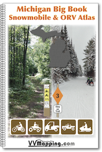
Our comprehensive Big Book for Michigan includes full coverage for the entire State. The book is 11" x 17", wire bound and full color. This book includes all of the Snowmobile Trail System and all of the ORV Trail System This is the single printed reference and planning book for year-round motorized use in Michigan. Sample Page and Map Legend which also shows how we depict the more complex "what machine is allowed on this road/trail". Features:
These books are constanty updated througout the riding season. No big pre-productions here, each book is created on-demand. Over 3000 miles of ORV Trails; over 6000 miles of Snowmobile Trails; Over 8000 miles of forest roads. Current Motor Vehicle Use Map information included for all three National Forests. Current DNR published State Forest Road map included for upper and lower peninsulas. Current township and county ordinances for ORVs on county roads. Commercial Forest Land and Hunter Access Land, non-motorized trails and more. Each trail has been documented with a GPS unit, the most accurate product available. Laser printed on heavy paper stock. Not laminated, not waterproof, but is water resistant. Questions? Please email us with your questions/suggestions. |
Our MI ORV Guide Book includes the same ORV information, but in a smaller format. Our MI Snowmobile Trail Map Book contains the same Snowmobile Trail information, but in a smaller format. Please send us feedback! What would make this more useful, what type of GPS do you use, etc.
Mailing List - Be notified of updates |