|
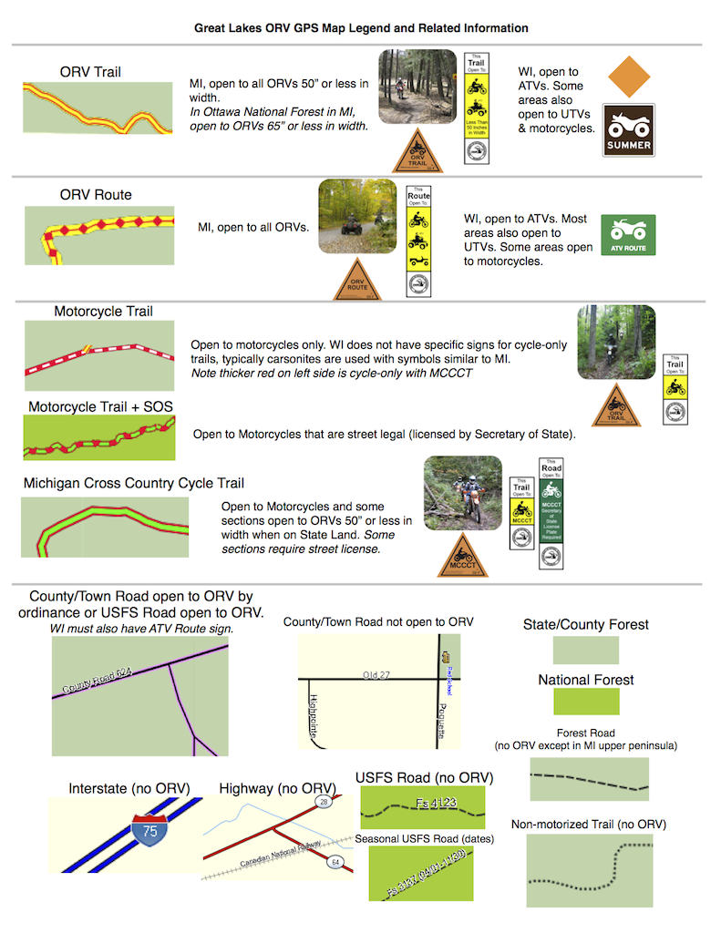
ORV Map Features at a Glance
GPS Screen
Samples on other page
All of the counties in Michigan are
covered. All of the public ORV Trail system is included. Gas stations
on or near the trail system, campgrounds with direct or near direct
trail access. Public land ownership information. Plenty more!
Current ORV Maps have these trail types
defined:
- Trail (All ORVs under 50" in width)
- Cycle Trail (open only to motorcycles)
- Cycle Trail SOS (motorcycles only and
must be street legal)
- MCCCT (Michigan Cross Country Cycle
Trail, ORVs under 50" in width & some sections require street
legal)
- Route (ORV Route, open to all ORVs)

  
Map Features and as seen on a
Garmin GPS

As seen in MapSource
Questions? Please email
us with your questions/suggestions. |